Image Credit: David Seibert
Year Erected: 1954
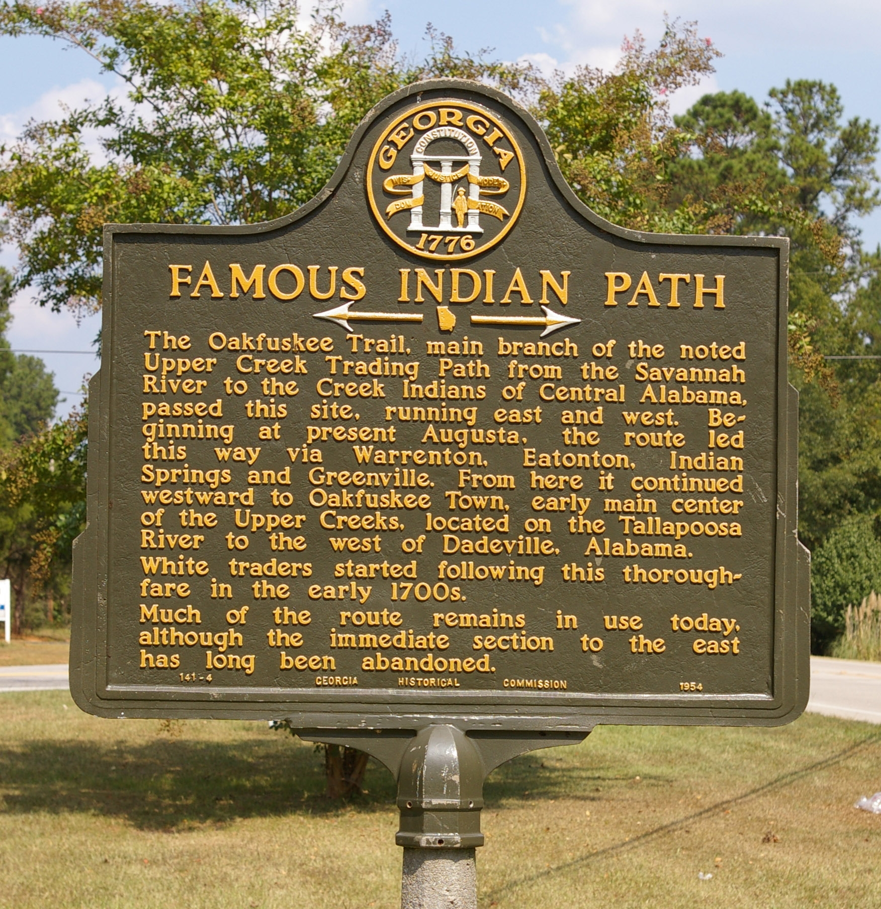
Marker Text: The Oakfuskee Trail, main branch of the noted Upper Creek Trading Path from the Savannah River to the Creek Indians of Central Alabama, passed this site, running east and west. Beginning at present Augusta, the route led this way via Warrenton, Eatonton, Indian Spring and Greenville. From here it continued westward to Oakfuskee Town, early main center of the Upper Creeks, located on the Tallapoosa River to the west of Dadeville, Alabama.
White traders started following this thoroughfare on the early 1700s.
Much of the route remains in use today, although the immediate section to the east has long been abandoned.
Tips for Finding This Marker: At the intersection of West Point Road (U.S. 29) and Upper Glass Bridge Road, on the right when traveling west on West Point Road in LaGrange.
Explore this marker and more through the Georgia Historical Society's interactive database.